07 March 2023
Eastern Indonesian waters, especially in Obi Island, are among the most productive waters in the world. This is because these waters are the meeting point between two large oceans, the Pacific Ocean and the Indian Ocean.
The meeting of the two large oceans is called the Indonesian Throughflow (ARLINDO). In Obi Island waters, ARLINDO passes through the northern part of Obi via the north of Bisa Island, the western part of Obi, and the southern part through the south of Gamumu Island. This allows the productivity of Obi Island waters to be very high.
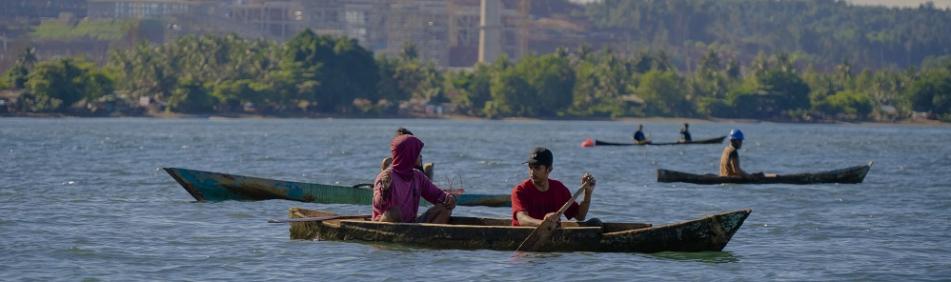
The productivity of Obi Island's waters is indicated by the number of pelagic fish—a group of fish that reside in the surface layer of water—in the area. The presence of these fish, according to a lecturer at Diponegoro University's Department of Oceanography, Prof. Dr. Denny Nugroho Sugianto, S.T., M.Si. has a positive impact on the sustainability of fisheries productivity in Indonesia.
"Primary fisheries productivity is closely related to oceanographic conditions that bring nutrients for phytoplankton growth near the sea surface, thus enriching the biomass in the area," he said.
"ARLINDO from the Pacific Ocean to the Indian Ocean will bring many benefits to Indonesia because of the high productivity of fisheries or waters. It will bring large pelagic fish species, and the pattern will be followed by tuna, skipjack, and other large fish. This has a positive impact on the sustainability or productivity of fisheries in Indonesia," he explained.
To maintain productivity, ensure fisheries sustainability, and prevent disruption of the marine ecosystem in Obi Island, Harita has made a number of environmental management efforts. These efforts include regulating activities at the port, such as rules for ships not to dispose of waste in the Obi water area, releasing ballast water from ships in waters far from the port, and placing anchors in designated areas. This program aims to ensure that environmental management is carried out in accordance with regulations and runs at its best.
Several marine monitoring programs were also conducted, including monitoring of seawater quality (physical and chemical parameters), marine sediment quality, and marine biota (plankton, benthos, coral reefs, and reef fish). The implementation of this program is supported by ocean monitoring vehicles and equipment with well-tested technology.
The marine monitoring vehicles and equipment consist of in-house survey vessels, seawater sampling equipment integrated with seawater column profile measuring instruments (Conductivity Temperature Depth - CTD meters) equipped with sensors measuring physical parameters of seawater, grab samplers, and Remotely Operated Vehicles - ROVs (underwater 'robots' to support marine management and monitoring programs, explore, and inspect underwater conditions directly).
Influenced by Oceanographic Factors
The productivity of Obi Island waters and its surroundings is strongly influenced by oceanographic factors, namely ARLINDO, sea surface temperature, and chlorophyll-a concentration. This is in line with the statement of the Director of Health, Safety, and Environmental Trimegah Bangun Persada, Tonny H. Gultom. In his opinion, the primary productivity of water is closely related to oceanographic conditions.
Trimegah Bangun Persada is a National Strategic Project mandate holder that operates nickel mining and downstream projects in Obi Island, South Halmahera.
In line with Prof. Dr. Denny Nugroho Sugianto, S.T., M.Si, Tonny also said that the highest distribution and concentration of Chlorophyll-a in Obi Island are in the northern part, in addition to the distribution of warmer water surface temperature conditions in this part. This circumstance suggests that the waters in Obi Island's northern parts are more productive than the island's other water sections. For your information, Harita Nickel's operational area is in the western part of Obi Island.
Furthermore, the distribution of fishing businesses is also more concentrated in the northern part of Obi Island (north of Bisa Island) and the southern part of Obi Island (south of Gamumu Island). This condition corresponds with the presence of ARLINDO, warm surface water temperatures, and high water concentrations in these waters.
Despite many factors affecting the productivity of Obi Island's waters, Harita is committed to keeping Obi Island's waters undisturbed through various programs delivered by the company and third parties. This program is also coupled with other initiatives to mitigate impacts that may result from nickel mining and downstream operations.
Harita also implemented an artificial reef placement program in stages, starting with a target of 1,000 pieces using hollow concrete cubes. The placement of artificial reefs aims to enrich the local ecosystem, as good coral reef conditions will be able to maintain the lives of reef fish and other marine life, ultimately benefiting the local community.
Harita also performed mangrove rehabilitation in several villages in South Halmahera, including Soligi Village in Obi Island, Guruapin Village in Kayoa District, and Belang-belang Village and Awanggo Village in Bacan Subdistrict. Mangroves have been gradually planted in an area of 20 hectares with a total of 47 thousand seedlings.
The establishment of mangrove forest areas will help maintain the availability of fish resources in the sea, clean water, and fresh air. Mangroves are also well-recognized for their ability to prevent erosion and abrasion.
* translated from Liputan6.com
Go Top